fsMapViewSetAltitudeReference
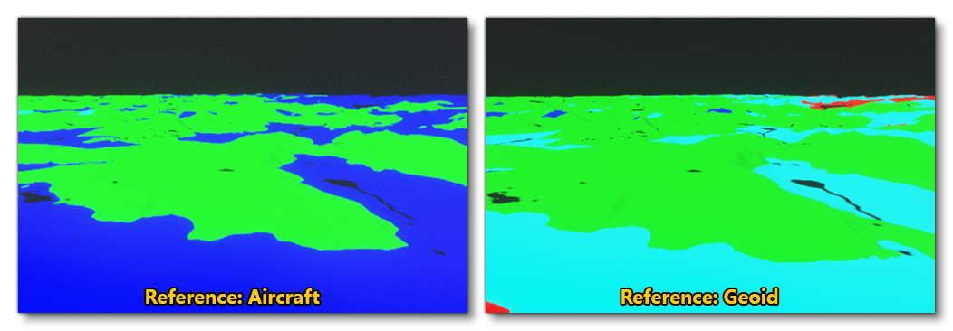
This function can be used to select which point of reference will be used to compute altitude. This function is only valid when the fsMapViewSetViewMode is set to "Altitude" view mode.
Syntax
bool fsMapViewSetAltitudeReference(
    FsContext ctx,
    FsTextureId id,
    FsMapViewAltitudeReference eRef
    )
Members
| Parameters | Description |
|---|---|
ctx |
A value of type FsContext provided as an argument of the gauge callback. |
id |
The MapView render ID as returned by the function fsMapViewCreate. |
eRef |
Set the altitude reference to be used for the MapView. See the Remarks for possible values. |
Return Values
Returns false
- if no texture matches the given MapView ID
- the
ctxis invalid - the given
eRefis invalid
Otherwise it will return true.
Remarks
The table below shows the available references for the MapView altitude:
| eModes | Description |
|---|---|
FS_MAP_VIEW_ALTITUDE_REFERENCE_GEOID |
Altitude colours will be applied with reference to the height from the Geoid (MSL) |
FS_MAP_VIEW_ALTITUDE_REFERENCE_PLANE |
Altitude colours will be applied with reference to the current aircraft altitude. |

See Also
- NanoVG API
- fsMapViewCreate
- fsMapViewSetViewMode
- fsMapViewSetAltitudeColorList
- fsMapViewSetAltitudeRangeInFeet