THE RENDERING MENU
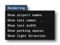
This menu permits you to enable/disable some extra rendering details within the simulation. The options available are:
-
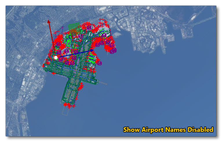
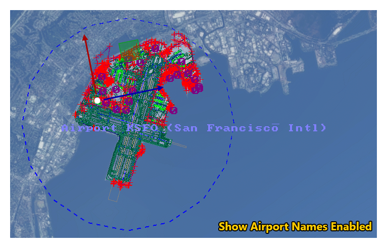
Show Airport Names
When enabled, this will show the name of the airport and also show the area that the airport covers (as a blue polygon edge). Mouse over the image below to see the difference.
-
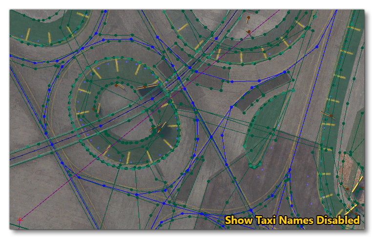
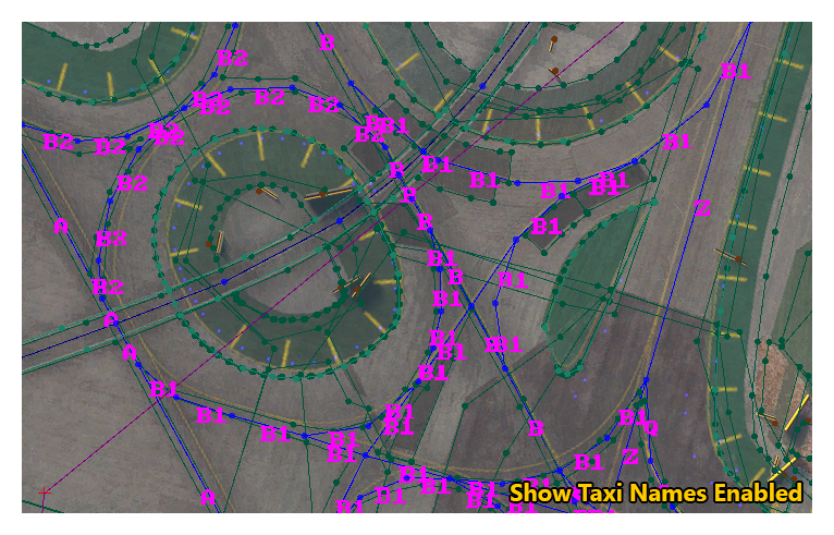
Show Taxi Names
This option will show the names of the different taxiways when enabled, as shown in the images below (mouse over the image to see the difference).
-
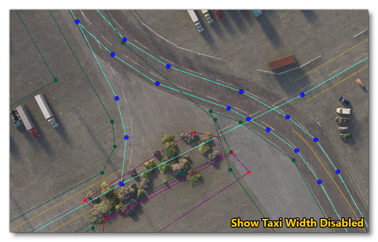
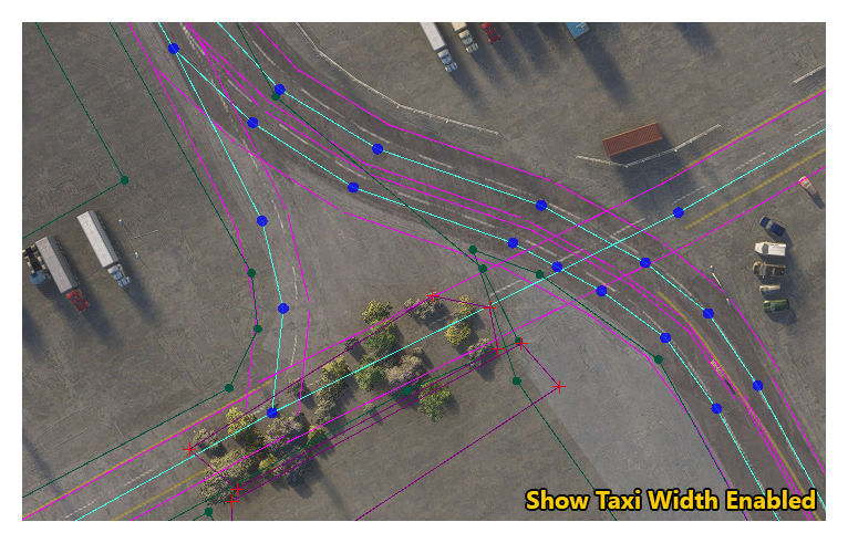
Show Taxi Width
By default, taxiways are drawn as a single path of lines connected by points. Enabling this option will also render the width of the taxiway, as shown in the images below (mouse over it to see the difference).
-
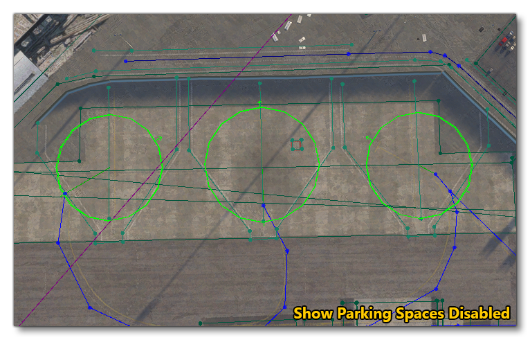
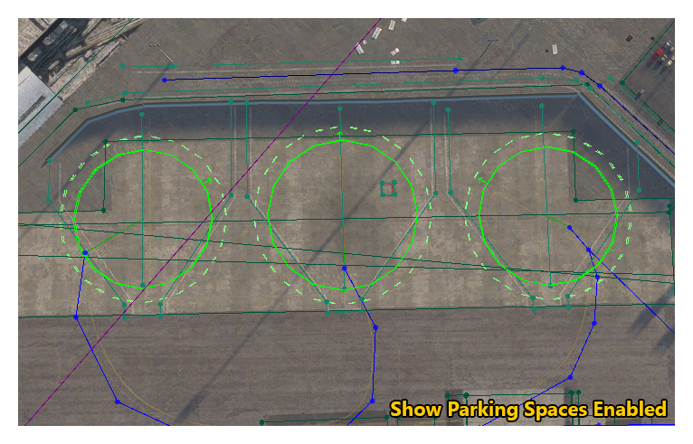
Show Parking Spaces
Parking spaces are shown by default in the simulation, but when you enable this option, an extra circle will be drawn around the parking space that indicates where additional items can spawn (for example, ground vehicles). Mouse over the image below to see the difference.
-
Show Light Direction
When creating Light Presets (Not available for World Hub Airports) it can be difficult to get a "feel" for the different directions required, especially when working with Angled Directional or Fresnel lights, for example. Enabling this option will help with this, as it will render - on the first light of the LightRow Object using the preset - two lines:- a white line which represents the preset Direction parameter
- an orange line which represents the preset Direction2 parameter
As you edit the values for Direction and Direction2, these lines will show the vector formed by the light position and the direction x/y/z position.
