VDGS OBJECTS
A VDGS object is an object element that is used to add a Visual Docking Guidance System to a stand at an airport. The VDGS is a system used to assist aircraft to dock at the exact position in front of respective gates, and in the simulation this is created as a SimObject which can be added to the airport on all the relevant gates with TaxiwayParking Objects (this objects is required to use VDGS). When you select this object type you will be presented with a list of many object elements listed in the Objects window:
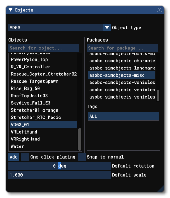
Since VDGS are a type of SimObj, all available sim objects are shown in the object element list. You should select All packages and All tags, then use the filter option in the Objects window to locate the VDGS that you wish to place:

IMPORTANT! VDGS objects require one or more Airport Objects to be present in the scene, and must be added to an airport group in The Scenery Editor. If no airport is present then they cannot be used. Also note that if they are placed too far away (ie: outside the airport Object Test Radius) then they will not be rendered.
Placing A VDGS
In general you won't be using the Objects window to place a VDGS, since they are dependent on TaxiwayParking Objects. When you first add a parking object to the scene, the Scenery Editor will automatically create a sub-group for adding a Jetway and a VDGS to it. The VDGS is not obligatory and so there is no error shown if one is not added (unlike for a Jetway). There are two ways to add one to the parking spot:
- In the Taxiway Parking Properties click on the
Add A VDGSbutton and then choose which type to add (the default type, or a custom one). - Select the Taxiway Parking you want to add the VDGS to, then in the Objects window find the VDGS object to add and click on the
Addbutton.
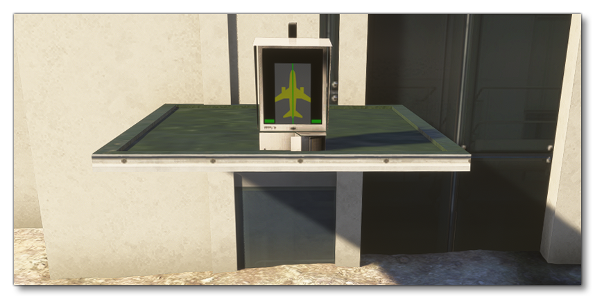
Once it has been added you can then use the Gizmo tool to place / scale / rotate the VDGS sim object as required for the airport. Selecting the VDGS will also open the Properties window, as explained in the section below.
VDGS Properties
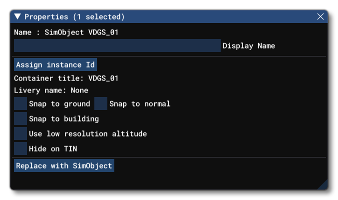
The Properties window for a VDGS looks like this:
-
Name
This is the name of the VDGS object as defined from its file and modifiers.
-
Display Name
This is the name of the VDGS SimObj as it will be displayed in the The Scenery Contents List. This can be edited and is helpful for identifying elements when you have a lot of items in the content list.
-
Assign Instance ID
Clicking this button will create a GUID-formatted Instance ID unique to the instance of the VDGS element placed within the simulation. This can be useful for many things like when creating mission scripts (for example).
-
Container Title
This shows the name of the VDGS "container" group as it will be shown in The Scenery Contents List.
-
Livery Name
The name of the livery that the object is currently using.
-
Snap To Ground
This option is enabled by default, and will "snap" the VDGS to the ground so that - regardless of the terrain height - the element will always be at ground level, even when moving it. Enabling this means that the altitude Gizmo does nothing, while disabling this will permit you to change the altitude. When this is disabled, you will have a new option present in the Properties window:
-
Offset To Ground
This value is the altitude from the ground for the jetway, and editing it will raise or lower the VDGS (and changing the altitude using the Translate Gizmo will also change this value automatically).
-
-
Snap To Normal
When enabled, the VDGS will change orientation based on the terrain surface normal underneath the center-point of the element. When disabled, it will maintain the default orientation regardless of the terrain underneath (or the orientation which is set using the Rotation Gizmo, and note that when enabled the Rotation Gizmo will only affect the horizontal axis around the center of the element). This option is disabled by default.
-
Snap To Building
When enabled, the VDGS object will snap to the sides of any procedural building. When disabled, it will maintain the default orientation regardless of the building beside it. This option is disabled by default.
IMPORTANT! This option will only work when the object is placed on a procedural building. No other building type will permit it.
-
Use Low Resolution Altitude
This option, when checked, will force the simulation to use a lower resolution altitude calculation when calculating the placement of the object in relation to the camera. In general this option only needs to be checked when the object is placed on a slope and you can see it "bounce" up or down in altitude as the camera gets closer/farther from it. Enabling this option should stop this changing visual altitude.
-
Hide on TIN
When checked, this option will hide the VDGS unless the TIN data is unavailable, for example when the user is offline, at which point it will be visible. The option is disabled by default.
-
Replace With
The
Replace with...button permits you to select a different Scenery object / SimObject / SimPropContainer for the tower object element:
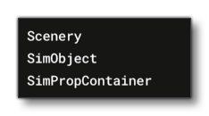 Depending on what you select from the window these options open, the properties for the object may change.
-
Convert To SimPropContainer
The
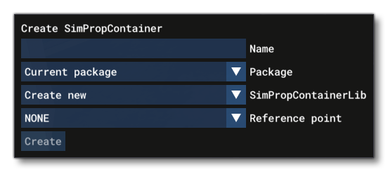
Convert To SimObjectContainerbutton permits you to convert the current Control Tower object into a SimPropContainer Object. Clicking this button will open a new sub-window with the following options:
-
Name: The name that you want to give the new SimProp.
-
Package: The package that the SimProp will belong to.
-
SimPropContainerLib: The SimPropContainer library to add the SimProp to (a new one can be created here if none exist already).
-
Reference Point: If the object has reference points defined for it then they will be listed here and can be selected as the main "central" point to be used for placing the SimProp.
IMPORTANT! Creating a SimPropContainer in this way means that the object model becomes the pivot reference for the entire SimPropContainer. From this point on, if you edit the model and re-export, you should not change the pivot position in your modelling program otherwise you will be changing the entire SimPropContainer reference pivot
-